Features Propriedade Segura
Advanced Rural Property Mapping and Navigation System Development ProjectThis project aims to create a highly advanced system for mapping rural properties, with an emphasis on optimizing Public Safety and reducing response times when responding to incidents.
The system will address the specific needs of rural areas, where geolocation and access to accurate information can be challenging.Main goals:1.
Detailed Mapping: The system will map all rural properties in the region, providing detailed information such as size, location, road access and relevant resources.2.
Advanced Geolocation: Advanced geolocation technology will be implemented to identify the precise location of security incidents or events on rural properties.3.
Efficient Navigation: The system will provide public safety authorities with efficient navigation to the incident location, significantly reducing response times.4.
Data Integration: It will be possible to integrate owner data, infrastructure information and property records, allowing a complete view of rural areas.5.
Real-Time Alerts: The system will be able to issue real-time alerts to public safety authorities and property owners in the event of incidents, ensuring a quick and coordinated response.Expected Benefits:- Significant improvement in the safety of rural areas.- Reduction in incident response times.- Greater coordination between public safety authorities and property owners.- Minimization of risks and losses on rural properties.- Increased efficiency in the management of security resources.This project represents a crucial advance in the security of rural areas, using cutting-edge technology to protect lives and property.
Collaboration between developers, authorities and property owners will be critical to its success.
Learning Tools
Enhance your learning experience with interactive features.
Food & Dining
Discover recipes and order food from your favorite restaurants.
Parenting Tools
Track and manage your child's development and daily activities.
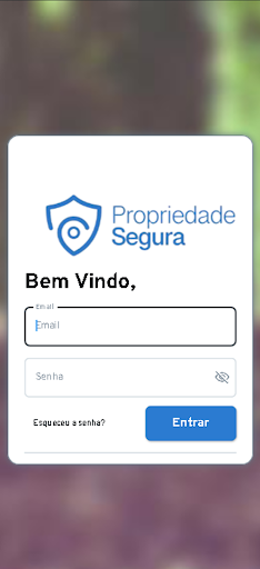
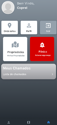
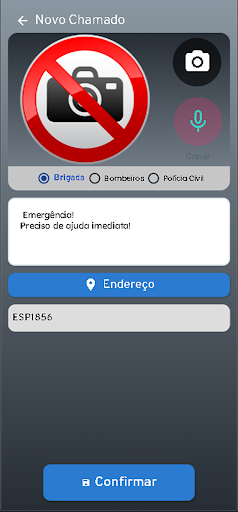
See the Propriedade Segura in Action
Get the App Today
Available for Android 8.0 and above